Click on the link to read the entire Governing article.
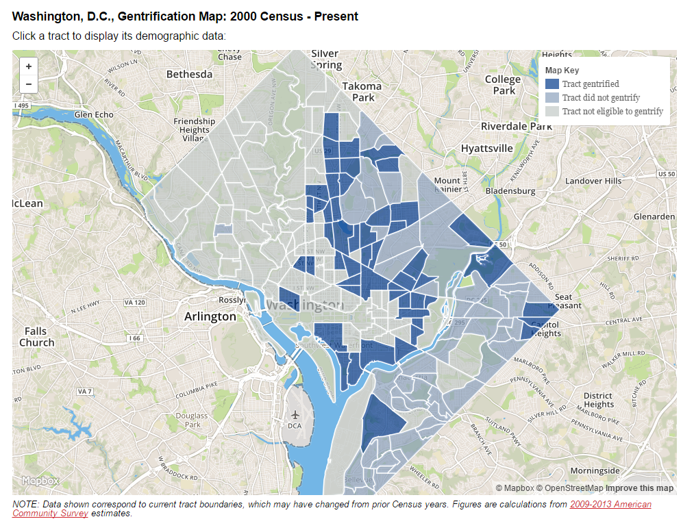
Note that the census tract that includes Bates/Truxton Circle/Hanover is labeled as “gentrified.”

![]()
www.governing.com/gov-data/washington-dc-gentrification-maps-demographic-data.html
To assess how gentrification has reshaped urban neighborhoods, Governing analyzed demographic data for the nation’s 50 most populous cities. Changes in several measures, described below, were calculated for each city’s Census tracts and compared to others throughout metro areas. While the methodology is similar to prior research on the subject, no universally accepted definition of gentrification exists.
Gentrification remains rare nationally. It did, however, greatly accelerate in many cities over the past decade.

One thought on “the census tract that includes the Bates area “is gentrified” (based upon the 2000 census data)”